We started early that morning, about
six o'clock I remember. We were soon heading north on the A9, sharing
the main north road with an endless stream of freight lorries and
fraught private vehicles, it would be the drivers who were fraught.
The A9 can be like that and usually is. After an uneventful three
hours or so we were on the Kessock Bridge at Inverness, then over the
Beauly Firth and onto the Black Isle. It is neither an island nor
black. It is in fact a peninsula and it is thought the 'black'
reference was due to it not retaining snow cover as long as the
surrounding land and hence it looked black against the white of the
snow. An old wives tale, who knows? The Black Isle however was once
known as Ardmeanach; gaelic in origin and from the gaelic word ard,
meaning height and maniach
meaning monk. It seems that derived from an ancient religious
building on high ground near Mulbuie.
We were soon over the spine of
Ardmeanach and crossing the causeway to the 'mainland' at Ardullie
where, with breakfast beckoning, we stopped at the relatively new
visitor's centre and coffee shop. It is worth a stop.
It is after ten o,clock before we
emerge into a cold day and continue our journey. We detour over the
Struie Hill road, thus missing out Alness, Invergordon and Tain and
also cutting the corner off the Portmahomack peninsula. There is an
interesting phenomenon on the Struie Hill road, similar to the so
called electric brae in Ayrshire. At one short bit of the road you
think you are travelling uphill, yet if you stop the car and don't
apply the brakes, the car seems to gently run uphill. It obviously
doesn't, the whole effect being an optical allusion brought about by
the angle of the roadsurface to the surrounding land. The views over
the Dornoch Firth from the north side of the Struie Hill road are
spectacular. So, get your camera out and stop at the viewpoint, you
will not be disappointed.
Before leaving the Struie, let me tell
you a wee story. A long time ago I travelled to the top of the hill,
from the Edderton side, in a Bren Gun Carrier.
.jpg) |
| ours was not as big as this |
That is a square metal
box running on 'tracks' like a tank or bulldozer. I believe it was
referred to as a 'universal carrier' and was an armoured military
vehicle designed between the two world wars to carry troops and
equipment and in particular, weapons. It was also used as a machine
gun platform, hence the nickname, 'bren gun carrier'. Production of
this vehicle, certainly in the UK, ceased in 1960. In it's time it
was reputedly the most produced armoured fighting vehicle in history.
Steering as far as I could see, certainly in the one in which I
travelled, was achieved by pulling in two brake levers, thus sending
the vehicle into a shuddering and violent turn to one side or the
other. Using that method my trusty colleague and driver weaved an
uncomfortable path up through the steep hillside to the very top. You
might wonder why I was taking this trip. Well, it had nothing to do
with warfare or transportation of weapons, it was far more mundane.
Our job that day was to take a barrel of creosote to the top of the
Struie Hill then paint the wooden hut that sits atop the hill. It is
no ordinary hut and is, or was, used to house the sophisticated
electronics needed to run the radio mast on the hill. In fact to this
very day a radio mast still adorns the summit. When our messy task
was at an end we sat beside the newly creosoted hut and had our lunch
whilst taking in the breathtaking view over the Dornoch Firth. It was
then I heard the sound of chattering voices getting ever nearer.
Despite looking all over the hill I saw not a living soul. As the
voices got even louder I was beginning to wonder about my eyesight.
Then I saw the source of the chattering. A huge skien of grey lag
geese to the north winging up the Firth and lower than my lofty
perch. It was a wonderful sound and still is. I can never hear
chattering geese now without recalling that wonderful day on the
Struie Hill and also recalling the Dylan song, 'lay down your weary tune'.
Ardgay is soon behind and we head west
on the delightful minor road that leads down Strathcarron to where it
changes from a tarred road to a cart track that leads all the way
through the mountains to Ullapool. That is for another day. We turn
left at The Craigs and are soon at our road end beside Glencalvie
Lodge. A quick change of gear, bikes out the car and off again south
along the cart track in Glen Calvie. After four kilometres or so,
just below the fine looking modern house at Diebidale, we ditch the
bikes, have a quick snack and head up a stalkers track that wends up
the north flank of Carn Chuinneag, our mountain destination for that
day. It is a cold day with a grey covering of high cloud. The track
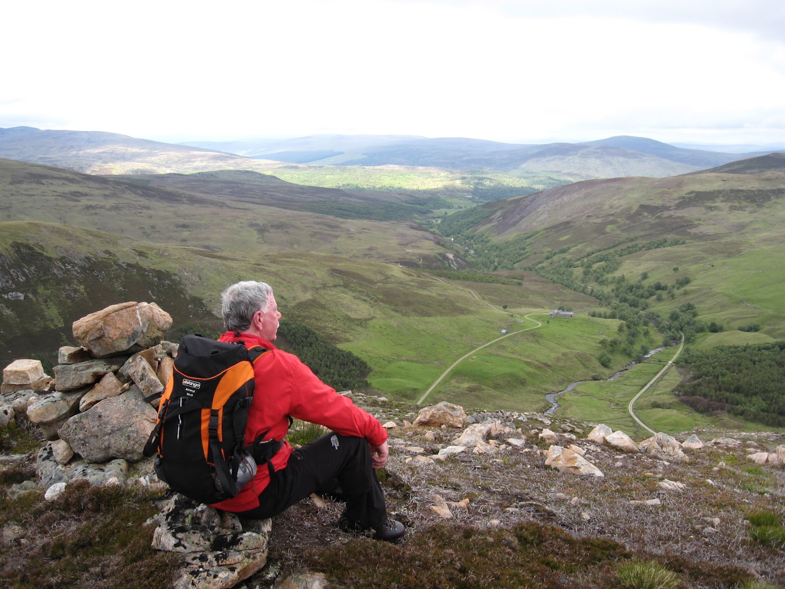
leads almost to the summit so routefinding and walking is a dawdle.
Like many corbetts this one sits apart from the other, bigger
mountains thus making for expansive and spectacular views.
 |
| carn chuinneag over diebidale |
On looking down we see that the track
we cycled up is seen to swing east, just where we left our bikes and
meander like the silver track of a snail for miles into Easter Ross
somewhere in the direction of Alness. Ben Wyvis to the south west
looks within touching distance. Over to the west one can pick out the
Ben Dearg hills and more. We have lunch in this lofty perch whilst
debating what we see. Retracing our bootprints back to the bikes is
easy, as is the cycle back to the car. A nice outing, well so far.
At the car I pack two panniers and a
tent onto my bike. Dave drives off back the road and up the
Ullapool road to Atlguish Inn where he would meet up with some Auld
Gits at the bunkhouse for a couple of days hillwalking. I would join
them in a couple of days. I set off solo, west past Alladale Lodge
then south west down Gleann Mor to my 'campsite' for the night at
Deanich Lodge, about nine miles ahead. My cycle down the glen was
uneventful and very pleasant. The track, obviously well used,
provided a good off road cycle route. In the early part, at the
Alladale Lodge end, one cannot help notice the work going on to erect
miles upon miles of seriously high and strong fencing. It tracks
straight up steep hillsides and can be seen in some bits arching
along ridges on the skyline. Just like some of the great walls built
across mountains in Victorian times. I also read a couple of notices
that inform me a 'zoo' licence has been applied for. I am reminded
that the landowner has an idea, a plan, to return some 'extinct' wild
animals to these parts. Wolves and Lynx, if my memory serves me well.
Not sure about the tent if that goes ahead.
 |
| north east along gleann mor |
 |
| window overlooking river |
I come upon a lovely wee fisher's
shelter built into a bank of Abhainn a' Ghlinne Mhoir, the river I am
following down the glen. Trouble has been taken to build the banking
up round three sides and put turfs over the roof. It is unlocked so I
use it as my brew up and dinner stop. The shelter hangs right over
the river and that wall is completely glazed. What a wonderful spot.
As I continue down the glen the sun is lowering and the evening views
in the glen are stunning. I have to gingerly circumnavigate a herd of
highland cattle, complete with calves. They were not interested in
this lone cyclist in there midst as I sped on. The half a dozen
garrion ponies around the next bend seem more interested, however,
apart from two who would not move from the track, all was well and
Deanish Lodge hove into view around a buttress to my left.
 |
| deanish lodge is to left beyond bridge |
I would
soon be cosy in my tent, so I thought.
The area I thought would make a good
pitch was already bristling full of about a dozen large tents.
Obviously an organised group. I saw a couple of land rover type
vehicles parked near the lodge. Undaunted I cycled on and found a
less then satisfactory spot about four hundred metres further on. I
then set about getting my tent erected. It was about eight thirty by
then and I was looking forward to my cosy sleeping bag. Then I saw
the lone ranger, or was it the 'born leader' striding with purposeful
gait through the tent village, heading directly for my solo tent. He
was not carrying a friendly mug of steaming hot chocolate for me. I
smelled a rat.
The encounter went like this;
Born leader, 'Good evening, I see you
are going to camp here. The access laws make that legal.' I have
an educational party of young people in and I am responsible for
their safety and you have just arrived from nowhere.'
I look about for my tent peg mallet,
knowing I do not have one, but just trying to give me something to
think about before responding.
Tired traveller, 'I have not arrived
from nowhere I know exactly from whence I came. What is your expectation of this conversation?'
Before I go into what he replied, I
would like any poor sole reading this to know something. I already
knew what he was about to say, hence my unsuccessful search for a
tent peg mallet I didn't even have with me.
Born leader, 'As I am responsible for
the safety of the young people and I don't know anything about you
and with the issue of pedophiles, I have to be careful.'
Tired (angry) traveller (now wishing he
had found a tent peg mallet), 'Oh, I thought you came over to
apologise in advance for any noise that might keep me awake or in
case some of your young people fling my bike in the river, as a
prank, not meaning any malice. You know I think the best thing you
could do, in terms of keeping people safe, would be to go back to
your billet and make them all a cup of tea.'
Born leader then wandered off and Tired
traveller got into sleeping bag and soon was fast asleep, dreaming about Born leader on stag (army expression for lookout) for the rest of the night making sure I stayed in my tent. Dolt.
What is this stupid fucking world
coming to?
It was my intention to climb a couple
of hills next day, however my slumbers were interrupted about six in
the morning by the feint pitter patter of raindrops on the tent. A
lovely noise. A peek outside found a glowering grey cover hiding all
the hills. I breakfasted inside the tent and listened as the pitter
patter got stronger. By eight it was a full scale downpour that
looked set for the day. Decision made. Abandon the stupid hill idea
and get down the glen. Packing up a tent and loading gear into
panniers with the rain bouncing of everything and attempting to keep everything dry is not
easy. In fact it is not even possible. Bike and I are as one in our
misery as we splash down into Strath Vaiche. Visibility is limited in
the clag and downpour. Soon I am on a long downhill section and all I
can think about is, 'I'll have to cycle back up here some day.' On I splash for about eight kilometres. Halfway along Loch
Vaiche, at Lubachlaggan I pull of the track and eat the second
sitting of my breakfast. The rain has eased by now so I decide to
tackle Beinn a' Chaisteil from that point. It is a steep grind up by
the south west ridge. By the time the ground eases a bit, the rain is
back with a vengeance and the wind is howling. I cannot see much and
as I have left my map safely stowed in my waterproof bike pannier,
which is still attached to my bike, I am mapless. Hapless some would argue. I bail out. A' Chaisteil will
have to wait on the pleasure of my company.
The track out onto the main Ullapool
road, some eight or nine kilometres away, is again uneventful and
quite enjoyable as the rain stops and the clouds open to allow a
glimpse of blue sky. A further three kilometres on the Ullapool road
to the Altguish is easy.
I hang my
wet gear in the drying room luxuriate in a hot shower then head to the bar, no map required. The Auld Gits will
eventually find me. You need not know anymore.


.jpg)